GRAPEVINE AIRSTRIP TO BE CHARTED!

Team effort between the Recreational Aviation Foundation and the Arizona Pilot’s Association is producing great results! The process of placing the Grapevine airstrip back on the Phoenix sectional, replacing the closed airport symbol that has marked the place of the Grapevine for nearly 20 years has begun!
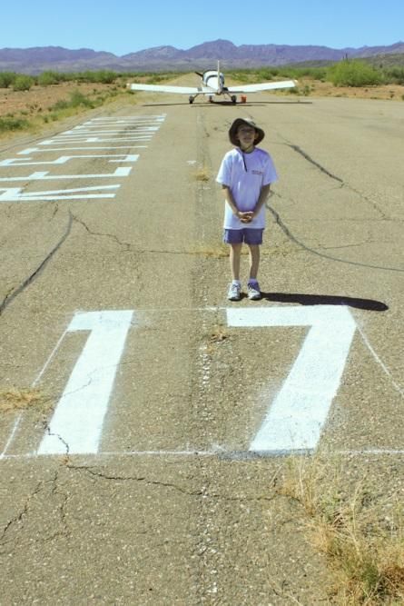
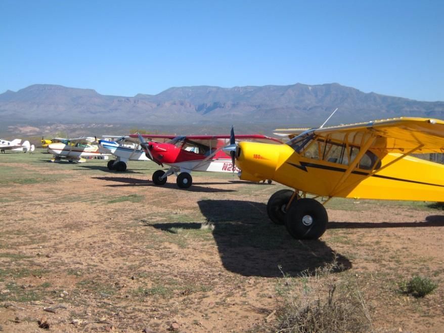
In  my mind, it seems like just last year that we had our first volunteer weekend at the Grapevine, clearing the cracks and runway edges of over 100 trees and shrubs that had made their attempt at reclaiming the airstrip to nature. Surely no volunteer from that weekend will forget the thorns and bloody mess they made of us all, and I’ll never forget DR Jardine standing there with what I could have sworn was a tear in his eye as I asked him what was wrong, “nothing, nothing, I just cannot tell you what this does for me to see all these volunteers willing to do this…” He went on to explain how lack of funding was forcing them to decommission a large number of the camp sites around the lake, for lack of funding and use, and how our group, willing to work for our vision of using the Grapevine airstrip again. There have been countless hours of volunteer work, tens of thousands of dollars in donations since then, and plenty of work left, but one thing I can say for certain is that these efforts and patience are paying off. Believe it or not, that was 2011, and Grapevine has become the most visited backcountry airstrip in Arizona, and even Forest Service Region 3 as a whole. Its unique hard surface, in a remote location, with no automobiles allowed, and only a short distance from the shores of Roosevelt Lake, have made it a popular place, and in many cases the only backcountry airstrip many pilots will ever visit.

We’re not finished with maintenance, and APA president, Tommy Thomason has already begun the work of lining up a company to help us surface seal the runway this summer. We’ve got some funds left over from the crack sealing and I know you volunteers are just chomping at the bit to get your sleeves rolled up and help as you have thus far! In any case, when you see the call for volunteers go out, don’t count on someone else if you can help yourself. 

As we learned with the Double Circle Ranch, now the first newly charted USFS airstrip in region 3 in decades, this process can take upwards of a year. It starts with the completion of the FAA’s 7480-1 form, which I’ll first submit to the FS, and after signature on to the FAA. This initiates an air space study, and upon approval, 3- 6 months, the 5010 form will be completed, and once approved, 3-6 months, the closed symbol will be removed from the sectional and the new identifier and appropriate info put in its place! Grapevine airstrip will not be without some restrictions, for example, no training, touch and go operations and such, and potentially some sort of reservation system for camping, but any restrictions will be there to secure long term safe access, and to keep the backcountry characteristics that draw most folks there. Make no mistake, the National RAF/USFS MOU was required by the Tonto Forest Supervisor before he’d here of moving this far on Grapevine before the MOU was complete. Hats off to the RAF and local pilots on this huge next step!

Submitted on May 7, 2016.


Posted in News

    Recent Posts
July 5, 2026
FEATURING: RAF PULASKI GLASSES Raise a glass to the work that keeps backcountry aviation alive! These RAF Pulaski Glasses are a perfect addition to your bar or a thoughtful gift for any aviation or backcountry enthusiast. Each glass features the RAF’s signature Pulaski tool, a tribute to the hardworking volunteers who preserve, improve, and protect airstrips across the country. Just like the tool itself, these glasses celebrate grit, utility, and a commitment to getting the job done. The Pulaski is a versatile, heavy-duty tool used for trail building, chopping wood, and clearing brush, making it an essential part of backcountry work for RAF volunteers. Made in the USA from high-quality glass, they’re built to last. Get yours today. 
By Carmine Mowbray July 1, 2026
You’d have a hard time finding a more beautiful place to fly than Driggs-Reed Memorial Airport (KDIJ). The Grand Teton, Big Hole, and Snake River mountain ranges surround this eastern Idaho valley. Driggs has become a world-class destination for the pilot community. National Geographic magazine listed Driggs as “one of the ten best outdoor recreation destinations in the U.S.” Just a 45-minute drive over Teton Pass is Jackson, Wyoming, a famous Western destination. The airport, at an elevation of 6,257, accommodates aircraft on both its 7,300-ft paved runway and 3,000-ft turf landing area, marked with cones. Note: The SW 3,451 feet of the paved runway is closed until August for reconstruction. Check NOTAMS before landing. Fly-in visitors are welcome to camp underwing at its grassy tie-down area. It’s an ideal gateway to the Idaho backcountry. Enjoy views of the nearby Teton Range from the 12' x 16' cedar pilot shelter. There is potable water, a toilet, power, a gas barbecue, and a charging station nearby. Within walking distance of the campground is the Forage restaurant. A bike shed and loaner bikes, provided by the Idaho Aviation Association Borrow-A-Bike program, are available to ride into town. If you desire a more urban experience or wish to explore further, the airport has rental cars. “It’s a great destination for the pilot community, with access to hiking, biking, fishing, floating, golf and a small town with numerous shops and restaurants,” RAF Director and Driggs resident Tim Riley says. He and a local RAF supporter recently completed a spring cleanup to ready it for the season. The amenities were provided cooperatively through the RAF, the Idaho Aviation Association (IAA), the City of Driggs, and its Airport Board, with financial contributions from each. For more information on Driggs, see the Airfield Guide . Submitted July 1, 2026 By Carmine Mowbray
June 30, 2026
It’s bear grass season around West Glacier, Montana, and nearly a score of volunteers from three different states drove in to Ryan Field June 12-13 to complete seasonal maintenance, and enjoyed spotting the showy blooms throughout the woods. Bear scat was also seen in several places – a reminder that a clean camp protects both campers and wildlife. The airfield remains closed until the new runway grass has stabilized for landing, so watch the Airfield Guide for an announcement that the field has re-opened. As a result, there was no annual Ryan Fly-in this year. Volunteers removed downed trees, cleared and marked hiking trails, mowed around the buildings and part of the runway, cleaned bear boxes, the pilot shelter, cabins, and barn. “We welcomed new volunteers and continue to work hard maintaining the field. We are as eager as everyone for the grass to take good hold so the runway can open again,” Administrative Director Tricia McKenna said. Submitted June 30, 2026
June 26, 2026
RAF President Bill McGlynn met in mid-June with the US Forest Service, Idaho Dept of Aeronautics, and Idaho Aviation Association to evaluate steps to improve Magee (S77) airstrip, 23 nm east of Coeur d’Alene. On the way, Bill picked up Joe Sober, one of two airport engineers from Oklahoma City who have volunteered their professional services and have been instrumental in creating maintenance and remediation plans on Idaho backcountry airstrips. “The Forest Service engineering teams have too much on their plate just addressing roads, so having this resource to make airstrip engineering assessments and plans is instrumental to resolving challenges on USFS airstrips like Magee,” McGlynn said. The improvement project at Magee has been organized through a Cost Share Agreement that the RAF has with the USFS. McGlynn, Sober, Willy Acton of the Idaho Airstrip Network, along with USFS District Ranger Holly Hampton, Don Macintosh of IAA, Dan Conner of Idaho Aeronautics, and RAF Idaho Ambassador George Weaver investigated the sources of flooding that plague Magee airstrip every spring and analyzed means of redirecting the problematic water. Magee airstrip was created in the 1940s by the Corps of Engineers as a hidden fighter base in case of a Japanese attack on the western US coast. A dike that was built to channel water away from the runway has eroded over the past eighty years. Sober took numerous measurements and will develop a plan to submit to the USFS for approval. Work could begin over the next year or two to recover about 700 feet of runway. “We truly could not do this work without our volunteer engineers and are very fortunate to have their expertise,” McGlynn said. Weaver said, “The airstrip is a real gem, and the restoration work will make it a great backcountry destination.” Submitted June 28, 2026
June 26, 2026
“It was really nice to spend some time with Wyoming folks cleaning up a little piece of history,” RAF WY/UT Ambassador Karen Larson said of the May 30 work party at Medicine Bow airport, on the historic US airmail route. RAF Wyoming Liaison Joe Feiler organized the work and reports that about 15 people with a wide range of backgrounds arrived at 9 am to help. Attendees included RAF supporters, EAA Chapter 420 members, local residents, as well as Lee Cook, Medicine Bow airport board member and town council member.